Although in the next few days Hurricane Irma might make the next stops on Highway 41 look considerably different than they do in these StreetView scenes, I will carry on. Note that in this stretch of the highway, it's also called the "Tamiami Trail".
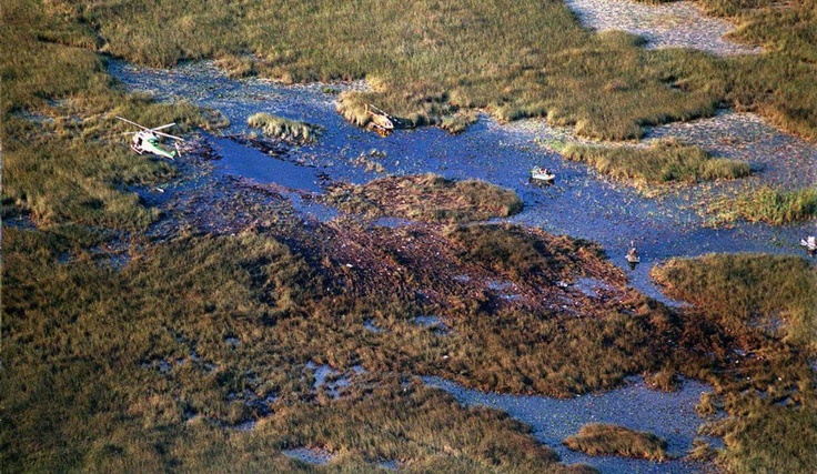
If you don't remember the Valujet 592 crash on May 11, 1996, it was notable partly because the plane basically got swallowed up by the Everglades. (
An article is here, and
a picture is here.) Until I undertook this Highway 41 project, I was unaware that there was a memorial at the crash site. But there is, and Highway 41 goes right past it. Zoom in with the "+" to get a closer look.
The next stop is the entrance to the Shark Valley Visitor Center (Shark River being the main still existent Everglades "river of grass"). There's an observation tower, not visible from here. Feel free to drive down the entrance road to find it.
And finally, just east of the Kirby Storter Roadside Park, I found this very Gladesy view.
Next stops: the road to Everglades City, and the road to Marco Island.

No comments:
Post a Comment